
Filter by
SubjectRequired
LanguageRequired
The language used throughout the course, in both instruction and assessments.
Learning ProductRequired
LevelRequired
DurationRequired
SkillsRequired
SubtitlesRequired
EducatorRequired
Explore the Geospatial Course Catalog
 Status: Preview
Yonsei University
Skills you'll gain: Spatial Data Analysis, Spatial Analysis, Geographic Information Systems, Geospatial Mapping, Database Management Systems, Big Data, Apache Hadoop, Data Modeling, PostgreSQL, Network Analysis
 Status: Preview
École Polytechnique Fédérale de Lausanne
Skills you'll gain: Geographic Information Systems, GIS Software, Spatial Data Analysis, Spatial Analysis, NoSQL, Data Modeling, Global Positioning Systems, Databases, SQL, Data Storage, Relational Databases
 Status: Free Trial
University of Toronto
Skills you'll gain: Geographic Information Systems, GIS Software, Spatial Analysis, Spatial Data Analysis, Geospatial Mapping, Query Languages, Data Processing, Data Manipulation, Image Analysis, Data Integration
Coursera Project Network
Skills you'll gain: Google Analytics, Marketing Analytics, Data-Driven Decision-Making, Web Analytics, Dashboard, Email Marketing, Geospatial Information and Technology, Marketing, Data Analysis
 Status: Free
Coursera Project Network
Skills you'll gain: ArcGIS, Data Presentation, Spatial Data Analysis, Data Visualization, Geographic Information Systems, Geospatial Information and Technology, Geospatial Mapping, Data Import/Export, Data Mapping, Data Manipulation, Data Management

Coursera Project Network
Skills you'll gain: Plotly, Exploratory Data Analysis, Scatter Plots, Plot (Graphics), Data Visualization, Data Visualization Software, Interactive Data Visualization, Python Programming

Skills you'll gain: Geospatial Information and Technology, Geospatial Mapping, Spatial Data Analysis, Applied Machine Learning, Geographic Information Systems, GIS Software, Environmental Monitoring, Unsupervised Learning, Data Analysis Software, Image Analysis, Machine Learning, R Programming, Data Processing, Open Source Technology, Data Transformation, Dimensionality Reduction
 Status: Preview
The Pennsylvania State University
Skills you'll gain: Geographic Information Systems, Systems Thinking, Design Thinking, Geospatial Information and Technology, Spatial Analysis, Community Development, Collaborative Software, Environment and Resource Management, Cultural Responsiveness
 Status: Preview
Universitat de Barcelona
Skills you'll gain: Physical Science, Water Resources, Geographic Information Systems, Geospatial Information and Technology, Chemistry, Environment, Environmental Science, Physics, Biology, Remote Access Systems
 Status: Preview
Georgia Institute of Technology
Skills you'll gain: Data Science, Data Mining, Data Integration, Data-Driven Decision-Making, Information Management, Engineering Analysis, Process Engineering, Big Data, Chemical Engineering, Structural Analysis, Predictive Modeling, Collaborative Software, Statistics, Innovation
 Status: Free
École normale supérieure
Skills you'll gain: Data Visualization Software, Geospatial Mapping, Graphic and Visual Design, Statistical Visualization, Geographic Information Systems, Quantitative Research, Data Mapping, World History, Color Theory
 Status: Preview
Ball State University
Skills you'll gain: Rmarkdown, Exploratory Data Analysis, Data Visualization Software, Ggplot2, Interactive Data Visualization, Statistical Visualization, Visualization (Computer Graphics), R Programming, Data Storytelling, Data Presentation, Histogram, Scatter Plots, Data Analysis, Data Manipulation
In summary, here are 10 of our most popular geospatial courses
- Spatial Data Science and Applications: Yonsei University
- Geographical Information Systems - Part 1: École Polytechnique Fédérale de Lausanne
- Spatial Analysis and Satellite Imagery in a GIS: University of Toronto
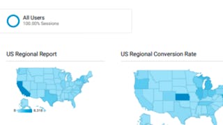
- Building Custom Regional Reports with Google Analytics: Coursera Project Network
- ArcGIS for Beginners: Mapping Urban Green Spaces: Coursera Project Network
- Data Visualization using Plotly: Coursera Project Network
- Satellite Remote Sensing Data Bootcamp With Opensource Tools: Packt
- Geodesign: Change Your World: The Pennsylvania State University
- Oceanography: a key to better understand our world: Universitat de Barcelona
- Materials Data Sciences and Informatics: Georgia Institute of Technology


